Wednesday, September 26, 2018

8/30: Last day in Marquette

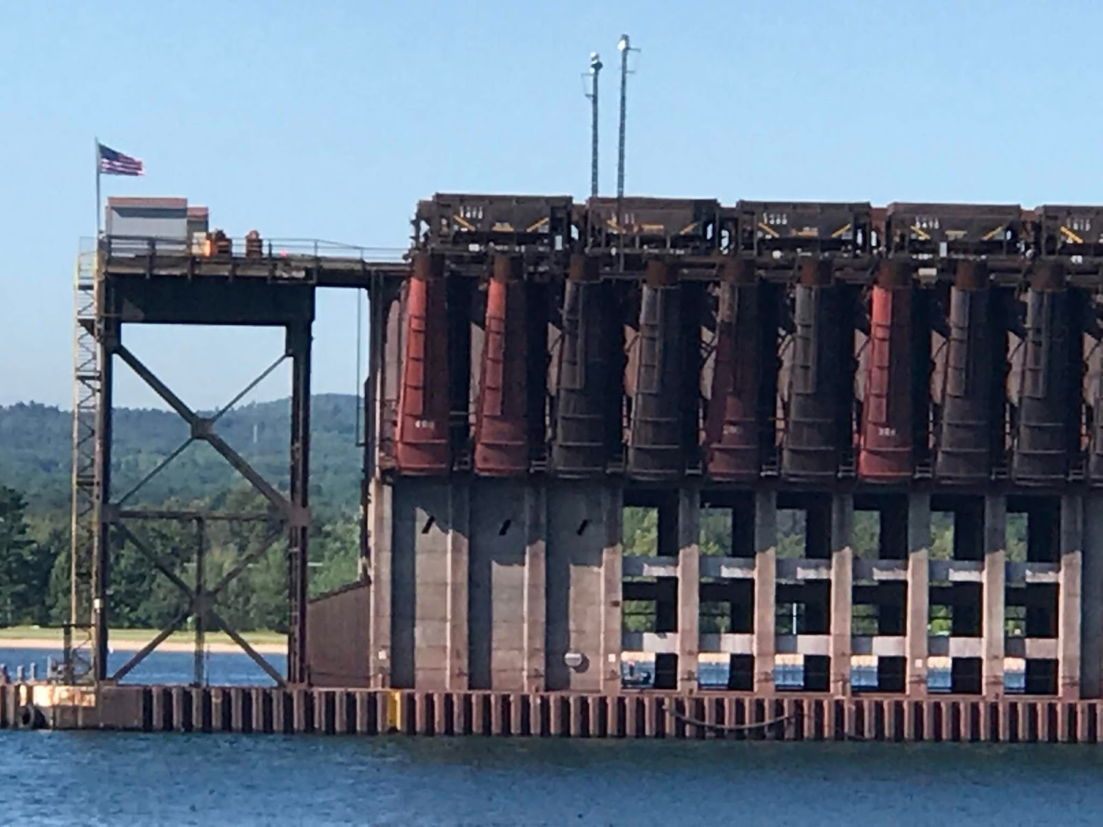
We started our day at Tourist Park, a campground owned and operated by the city of Marquette, conveniently located right on the trail network. Our first goal was to ride into town and through the town park. We passed the power plant and the large structure that allows ore train cars to dump their loads into ships. Definitely not what we would consider lovely scenery, but a suitably iconic structure for the IOHT, Iron Ore Heritage Trail.

The scenery improved immensely once we got into the park. Local cross country teams were warming up along the trails; it appeared that there would be a set of competitions as the day went on.


Then we dropped into the bike shop where Paula bought another sign -- the N+1 sign that she told you about in the last post. They also had other bicycle art that we liked...


Next up on the trail was a lighthouse that was built right into the watchman's home.


Then we picked up the Iron Ore Heritage Trail. I really liked their logo. We also recorded some of the historical plaques along the way.


The plaque about pelletizing iron ore was quite interesting. The process of turning ore into pea-sized pellets significantly extended the lifespan of iron ore mining in the region by making the mining of low grade ore profitable. Under one of the trestles along the trail, there was a shed cover to protect riders against pellets spilling from passing trains.  Underneath the trestle, the ground was covered in pellets, so we were able to get a good view of them. 

This was the Negaunee Public Schools Administration building. Paula decided she could have worked here. I reminded her she had already retired!

And here is the local mountain bike club's clubhouse. Pretty neat building. This area has an extensive network of mountain bike trails.

And wouldn't it be fun to renovate this amazing stone building (with an unlimited budget)?!?

And lastly two trail signs for mountain bikers: The Rusty Bike Trail and Sissy Pants Trail. With our trikes we decided to stick to the Iron Ore Heritage Trail. 54 miles today, almost all paved.

Tuesday, September 4, 2018

8/29 Marquette, Mi

Iron Ore Heritage Trail from Marquette, MI to Ispheming, MI

53 miles
Video highlights - can you find the deer?

Iron ore is a constant presence along the shores of Lake Superior. Marquette, home to Northern Michigan University, is no exception. The ore trains roll right out onto a specially constructed pier where the ore pellets can be dropped directly into the hold of the ore ships.

Ore Loading Pier adjacent to Presque Isle Park


We camped at the Marquette Tourist Park, a city-owned and operated campground and park on the Dead River. The town is very bike friendly and the trail network was accessible right from the park.

We visited Lakeshore Bike Shop and acquired the quintessential tin sign: Bikes = N + 1

The "Yoop" loves its Cornish pasties, a legacy of Cornish miners, so we had to try them out. The Lonely Planet recommended Jean Kay's Pasty shop, so we tried it out. We had a steak pasty and a vegetarian pasty with the housemade spicy ketchup sauce. Both were very tasty.

8/27 - 8/28 The U.P. -- Michigan's Upper Penninsula

This rainy morning we headed over the Mackinaw Bridge to the Upper Peninsula of Michigan.  Turns out the "Uppers" (say Yooper) have a different outlook than the lower portion of Michigan and have tried to secede multiple times. (Sounds familiar to our northern and southern California friends and family.)

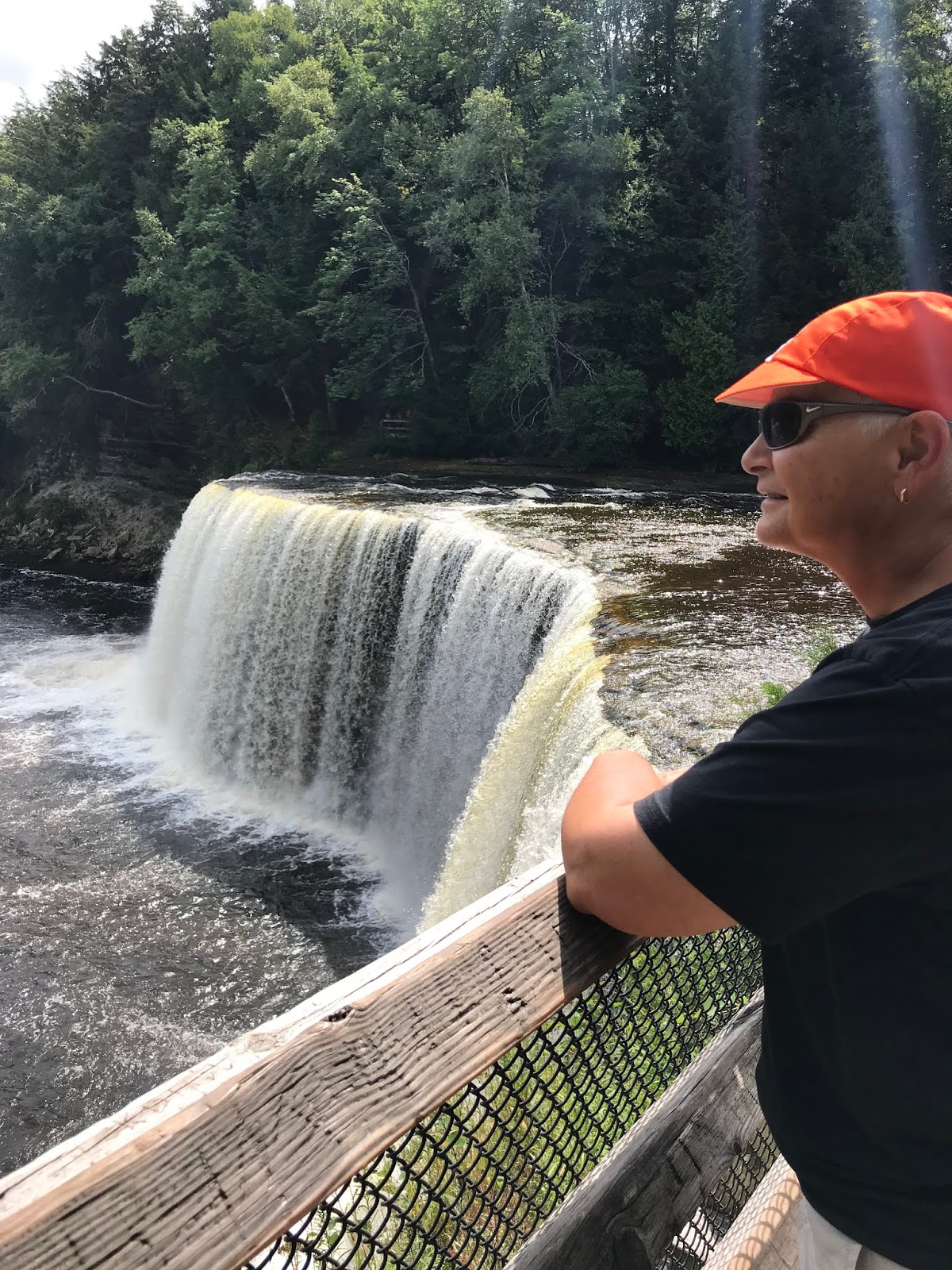
Since the weather was hot, steamy, and occasionally rainy, we decided to forego bicycle riding. Instead we hiked this relatively short path to see the waterfalls along the Tahquamenon River. We were amazed to find out they used this river to 'float' the cut timber down to sawmills in the southern part of the state.


We camped for two nights at Rivermouth Campground, which is a Michigan state park campground at the mouth of the Tahquamenon river. Delightful campsites at the river's edge with excellent facilities and hot showers.

The next day we went out to the Shipwreck Museum and Lighthouse at Whitefish Point just north of Paradise. Whitefish Point has claimed more ships than any other stretch of Lake Superior. In addition to the lake's notorious storms, the Point is a narrow and treacherous channel.

The ore carrier, Edmund Fitzgerald, at the time the largest ship plying the Great Lakes, went down in a fierce storm with all hands lost. Gordon Lightfoot memorialized it in his ballad, The Wreck of the Edmund Fitzgerald. Actual cause of the disaster remains a mystery to this day.

The lighthouse was originally a stone tower, but could not withstand the violent storms and winds of Lake Superior winter, so was replaced with this wrought iron version. The mechanism that kept the light revolving was similar to that of a grandfather clock and required winding every 2.5 hours. The lightkeeper's cottage was attached by a bridge to the lighthouse stairs so that the lightkeeper was spared some of winter's harshness as he rewound the light multiple times per night.


Paula's not a fan of heights, but can you see her up on the catwalk?

This cart was used to haul down the large timbers before they were dropped into the water for travel to the mills. The cart wheels were huge, and the logs were lashed to the structure, but the cart itself appeared very small.

Here's one of the natural sand dunes which was used to push the logs down to the water.
The forest service sign was attention getting though.

Beautiful coastline, but respect the weather.


8/26 Little Traverse Wheelway from Harbor Springs to Charlevoix

This was our last day at Mackinaw Mill Creek Campground, so we took the van to Harbor Springs as our jumping off point for the Little Traverse Wheelway Trail.

We rode through Petoskey, Bay Shore, and on to Charlevoix when we turned around. A total of 57 miles, all of it paved this time.  Here's some of our snaps...
Palatial trail council setting. We loved the stonework of the building.

These murals were on the back of a strip mall along the trail. Great way to avoid graffiti. Surprisingly we have seen very little graffiti along this entire trip. From the Top of Michigan Trails Council description...

The part between Petoskey’s Bayfront Park to Petoskey State Park follows closely the path of the original Little Traverse Wheelway that stretched from Petoskey to Harbor Springs in the 1880s and ‘90s. A gate over the trail at the east end of Bayfront Park proclaims “No Teaming or Driving,” and ... is a reminder of a time when people were prohibited from riding horses or horse-drawn carriages on the trail.


Beautiful scenery along the edge of the lake, and much resort potential. (We just rode by.)

This drawbridge was open and blocking our way into downtown Charlevoix. Since it didn't look like it would be shut anytime soon, we decided to turn around and take advantage of the temporary hiatus from car traffic that it created.

Kingston to Vantage, Wa; then Vantage to Sequim, Wa.

After helping Sandy celebrate her birthday, we all departed Kingston for our next stops. Sandy & Ann headed to Ellensburg, Diane headed ...